KAO-TerraMind: Targeted Adaptation of Geospatial Foundation Models for Dense Prediction
Abstract
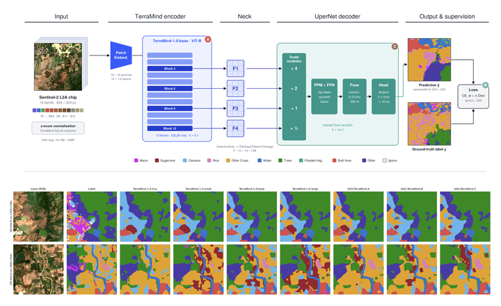
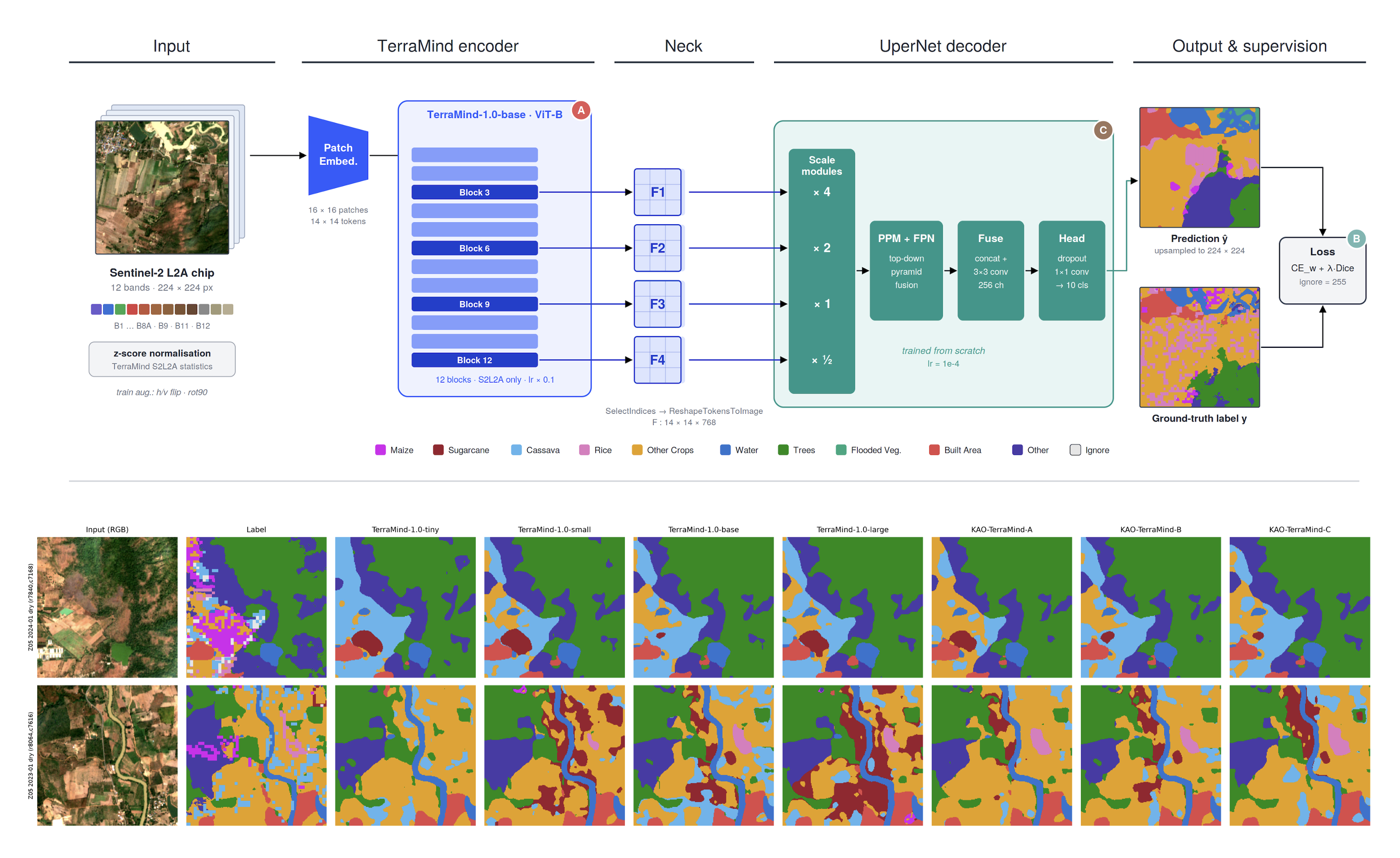
Geospatial foundation models (GFMs) such as TerraMind provide strong multimodal representations for Earth observation, yet they are typically adapted to downstream dense prediction tasks with a single, fixed finetuning recipe. We argue that this default is suboptimal and that which component of the pipeline is adapted matters. We introduce KAO-TerraMind, a targeted adaptation framework that starts from the pretrained TerraMind-1.0-base and systematically studies three controlled factors on top of it, (i) optimisation, through stronger backbone adaptation with a higher backbone learning rate and weight decay; (ii) loss design, through a larger Dice term that emphasises overlap on rare crop classes; and (iii) decoder design, through a wider UperNet head with deeper-biased multi-level feature taps and increased dropout. Each variant changes exactly one factor, which allows its contribution to be isolated in an ablation. On [DATASET], the decoder-focused variant (KAO-TerraMind-C) performs best, improving over the TerraMind baseline from 78.44% to 78.90% overall accuracy, 40.82% to 41.13% mIoU, 52.57% to 52.80% F1, and 52.63% to 53.03% mAP. The loss-focused variant improves mIoU by 0.14 percentage points, indicating a benefit for under-represented classes, whereas stronger backbone adaptation alone yields no measurable gain in mIoU. These results suggest that, for dense prediction, adapting the decoder and the way multi-level features are read out from the frozen-style backbone is more effective than simply updating the backbone more aggressively. We release our finetuning code and evaluation protocol to support reproducible comparison of GFM adaptation strategies.

Teerapong Panboonyuen
My research focuses on leveraging advanced machine intelligence techniques, specifically computer vision, to enhance semantic understanding, learning representations, visual recognition, and geospatial data interpretation.