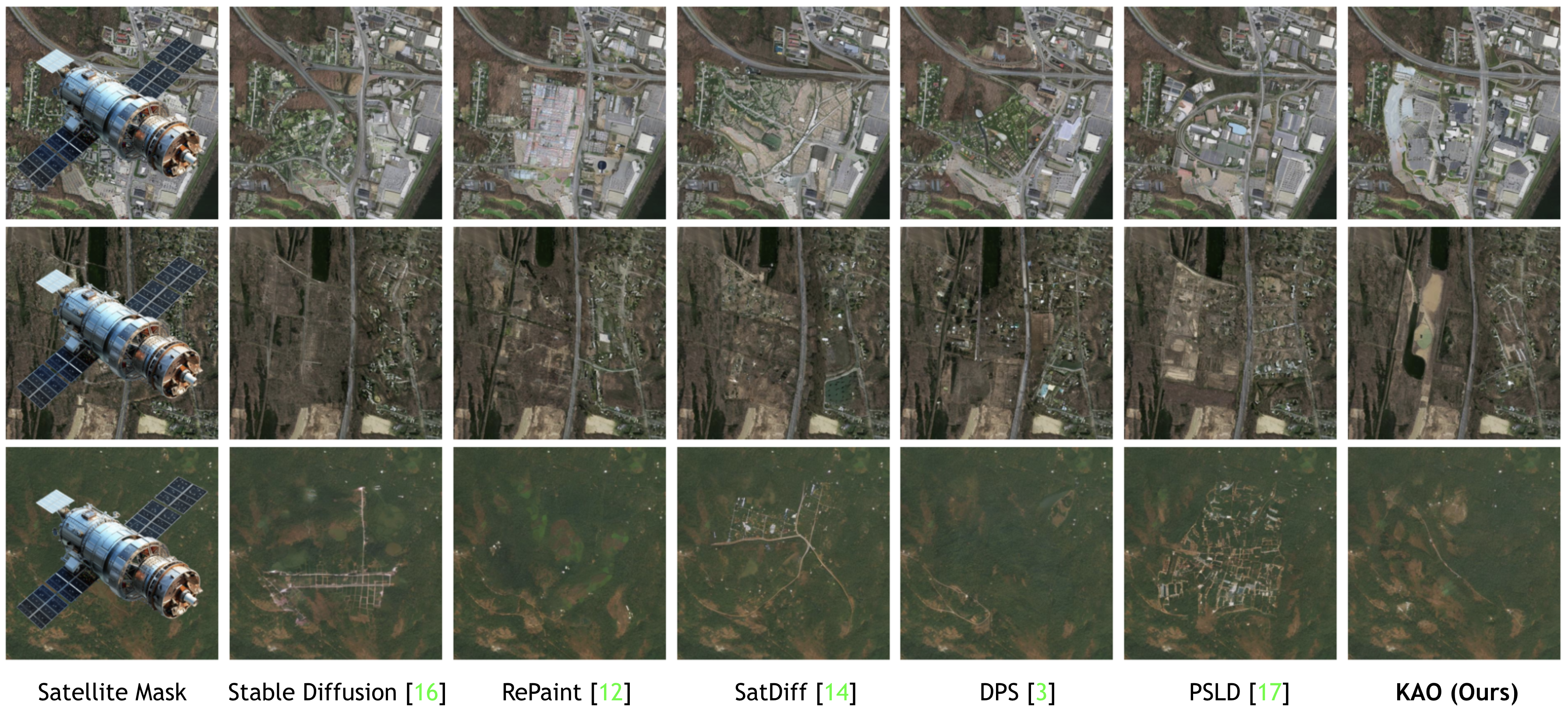
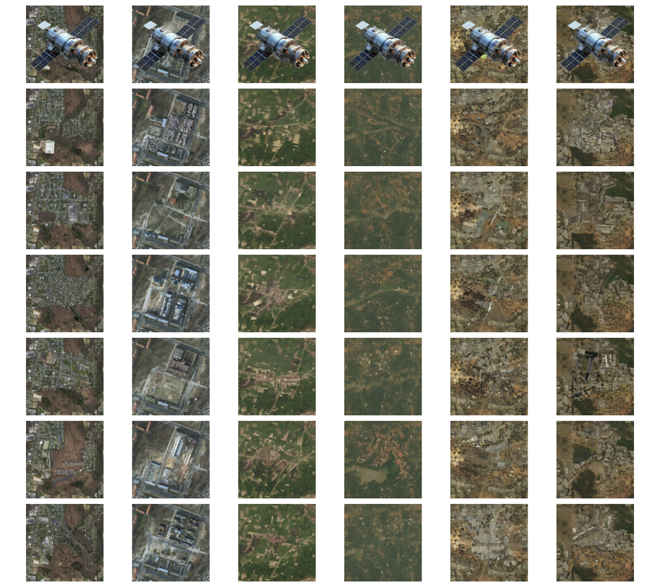
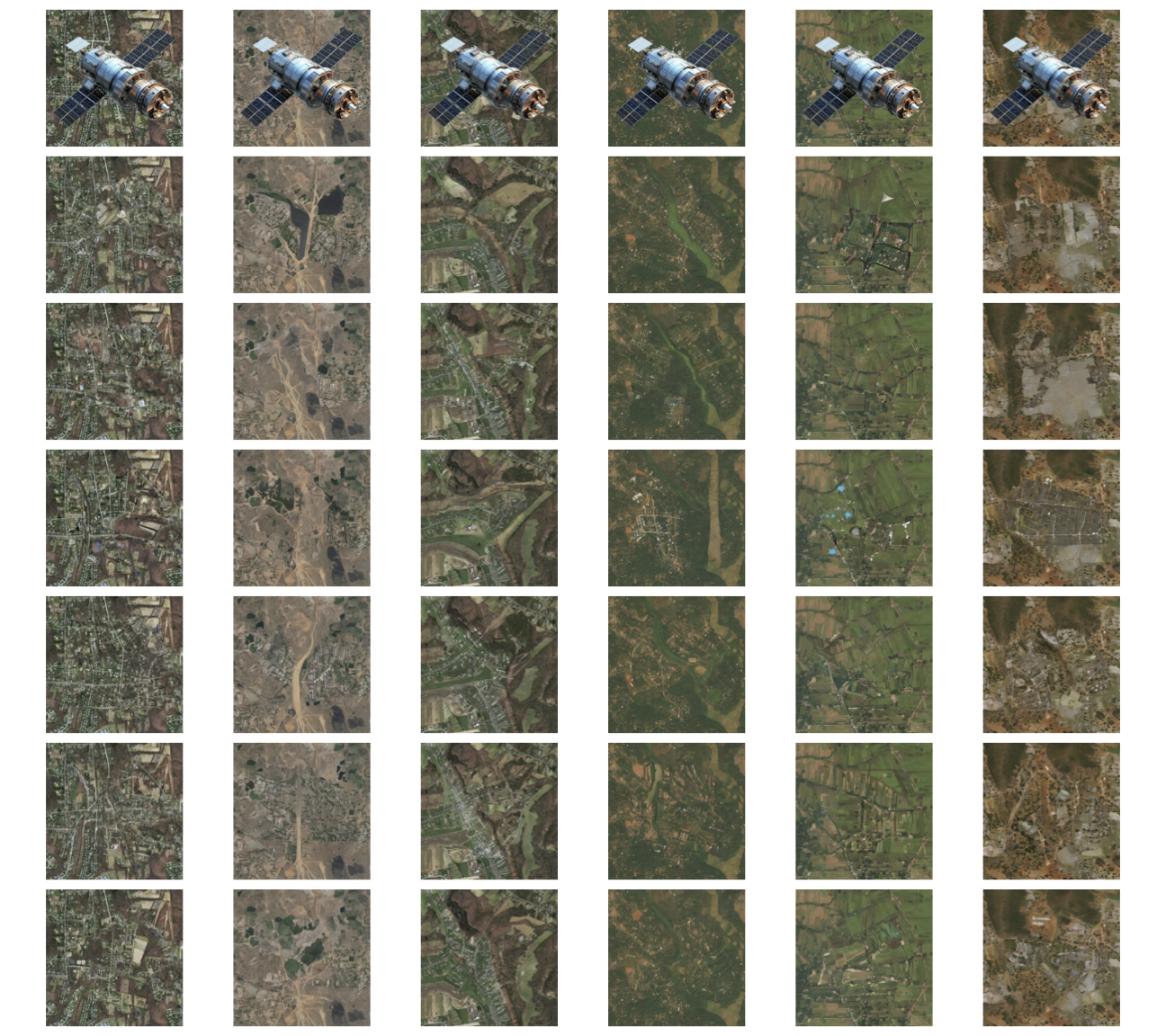
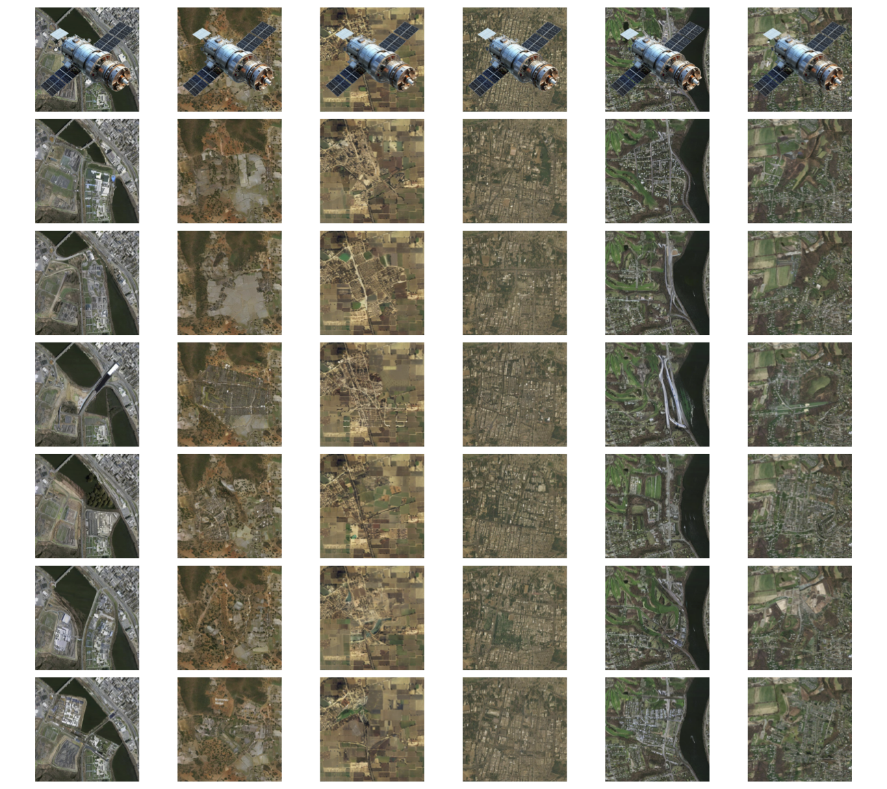
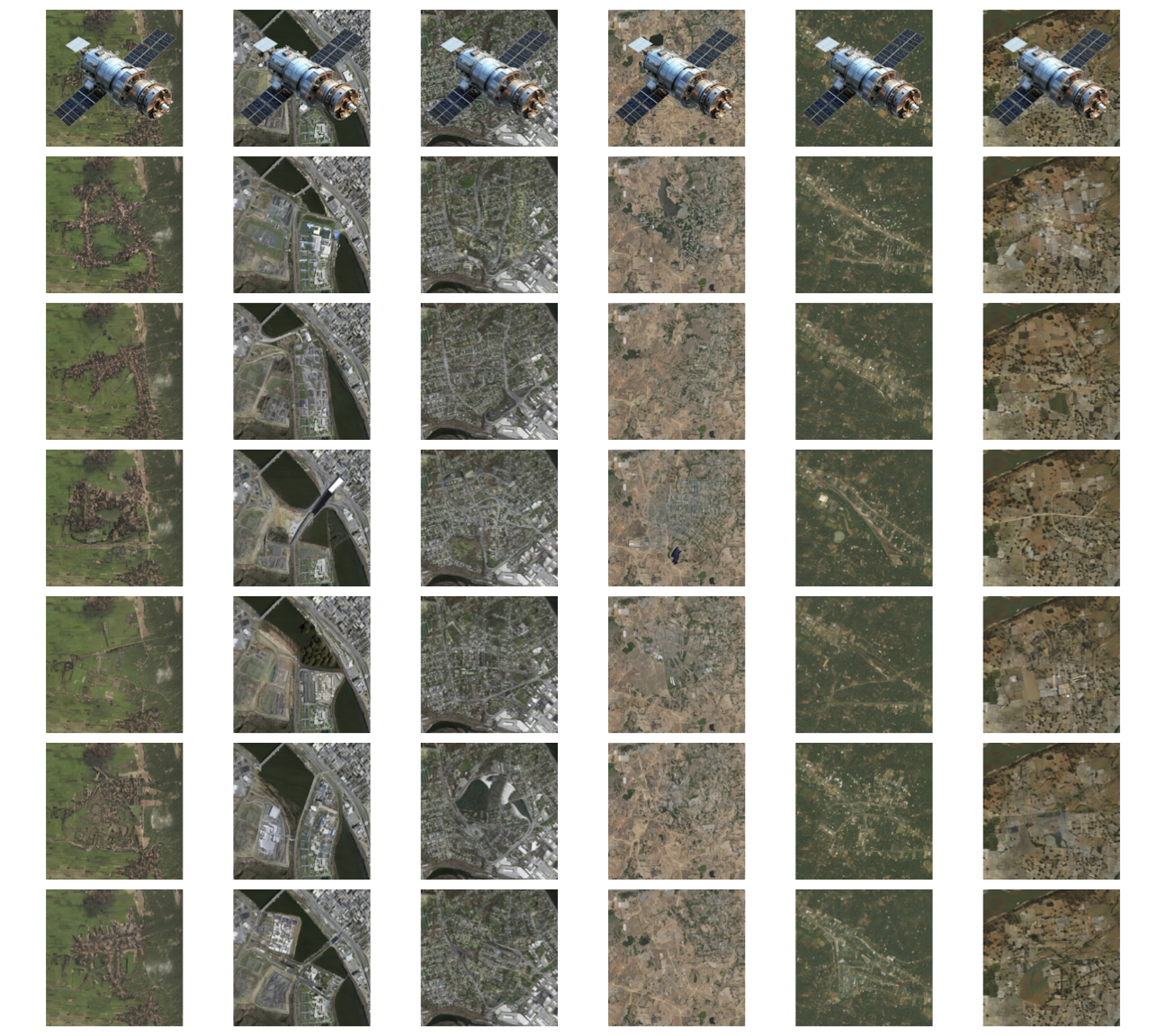
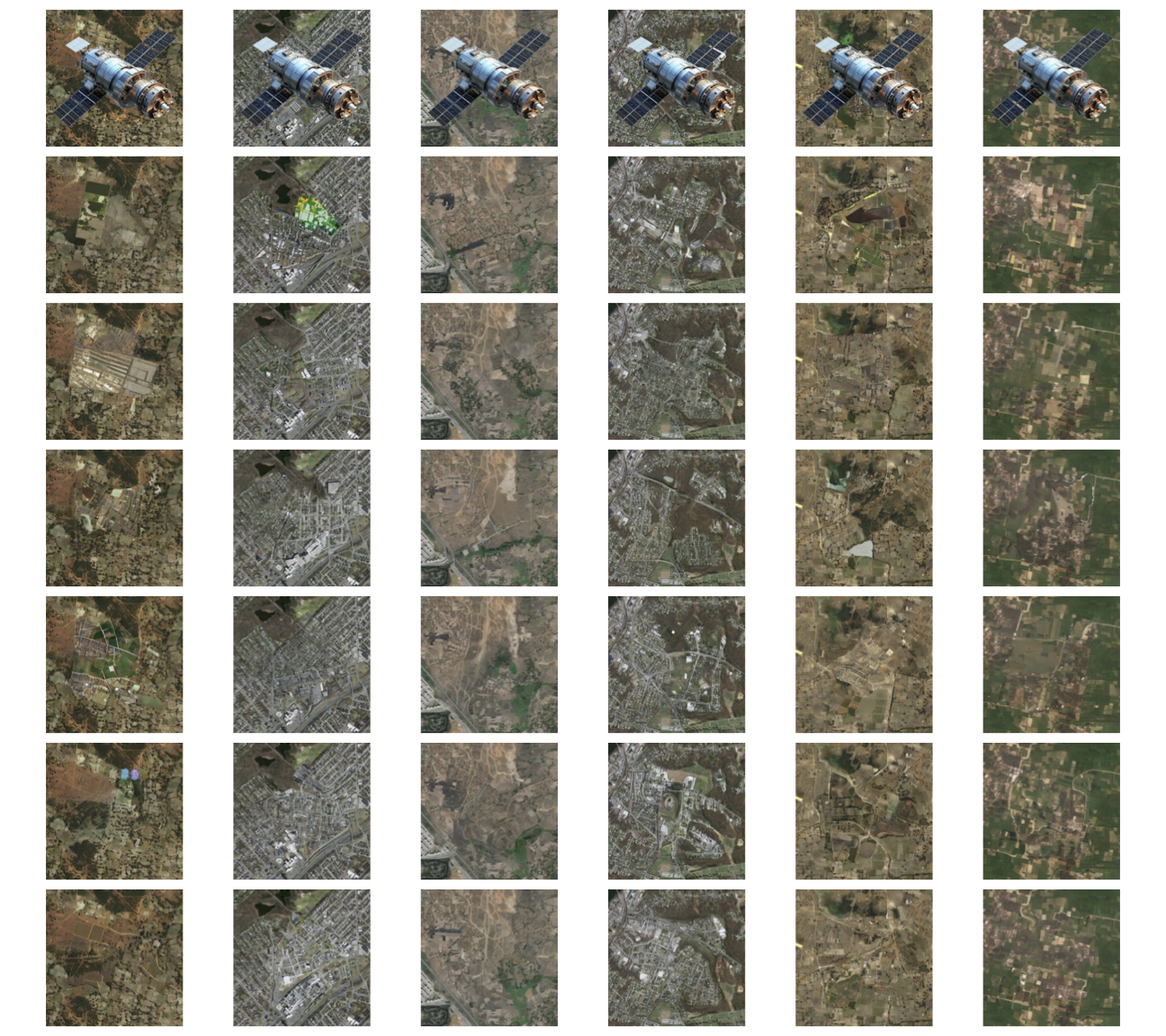
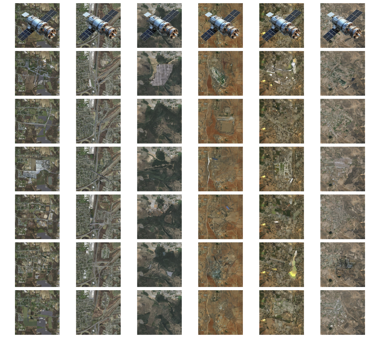
A diffusion framework for high-resolution satellite image inpainting across urban, forest, and agricultural landscapes. KAO introduces adaptive kernel-aware optimization for structure-preserving geospatial reconstruction and achieves superior fidelity over existing diffusion baselines.
KAO combines diffusion-based generative modeling with Kernel-Adaptive Optimization and Token Pyramid Transformers to reconstruct missing satellite regions with high spatial fidelity. The framework is specifically designed for Earth observation imagery where structural continuity and texture realism are critical.
This work has been invited for presentation at the 23rd Annual Meeting of the Asia Oceania Geosciences Society (AOGS 2026), showcasing generative AI for high-resolution satellite image inpainting across diverse geospatial environments.
View Official AOGS ProgramPreserves roads, buildings, and fine-grained urban topology under large occlusions and missing regions.
Maintains vegetation consistency, spatial continuity, and landscape textures across rural environments.
Dynamically modulates optimization focus using kernel-aware weighting strategies inside latent diffusion space.
KAO consistently generates sharper, more realistic, and semantically coherent reconstructions than Stable Diffusion, RePaint, SatDiff, DPS, and PSLD across challenging remote sensing scenarios.
Spatially adaptive weighting allows the diffusion process to focus on difficult reconstruction regions and semantic inconsistencies.
Robust latent diffusion sampling improves realism and preserves geospatial continuity under severe missing data conditions.
Designed for modern geospatial foundation models, Earth observation systems, and large-scale satellite intelligence.
@article{panboonyuen2025kao,
author = {Teerapong Panboonyuen},
title = {KAO: Kernel-Adaptive Optimization in Diffusion for Satellite Image Inpainting},
journal = {IEEE Transactions on Geoscience and Remote Sensing},
year = {2025},
doi = {10.1109/TGRS.2025.3621738},
publisher = {IEEE}
}